come hike with us!
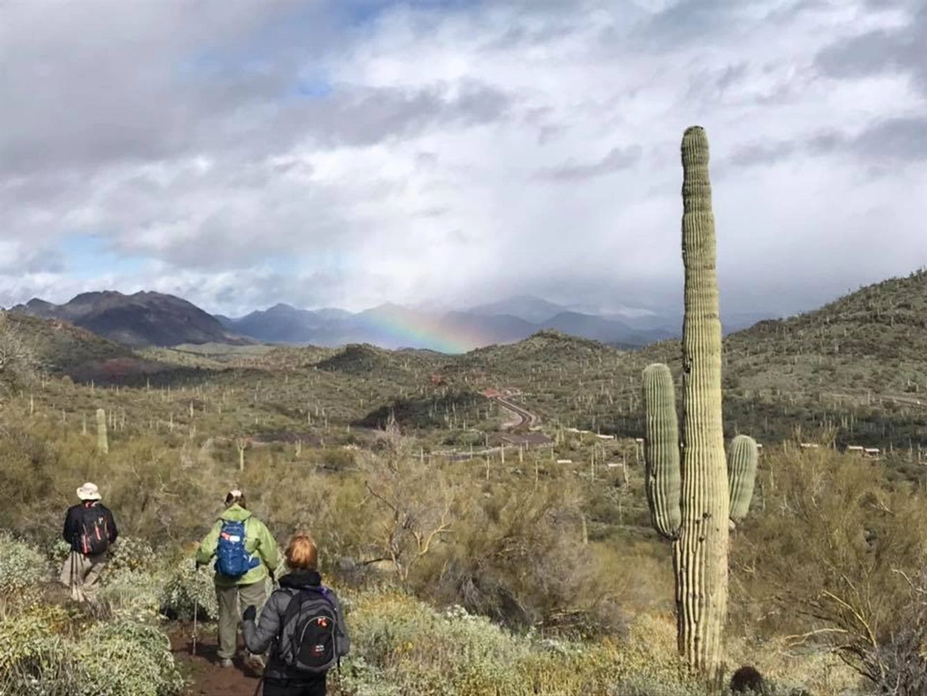
The PebbleCreek Hiking Club is now in its 20th season and is established to provide PebbleCreek residents with the opportunity to enjoy recreational hiking in an organized, safe and social environment. Safety is a key concern. Hikers are accompanied by a leader and sweep carrying an emergency satellite communicator, medical kit and walkie talkies.
The regular hiking season is from the third week of September to the first week of May. In this season the 12 hikes per week are scheduled at the following levels:
EZ Level hikes (1.0-3.0 miles) every Monday
D Level hikes (3.5-5.0 miles) every Tuesday and Thursday and sometimes Saturday.
C Level hikes (6.0-8.0 miles) every Monday, Wednesday, Friday and sometimes Saturday.
B Level hikes (up to 12 miles) every Monday, Wednesday, Thursday, Friday, and Saturday
A Level hikes (challenging hikes with unrestricted miles and elevation gain) are held on select Mondays in November through March.
The summer hiking season is from the second week of May to the third week of September. In this season six hikes per week are scheduled at the C or D Levels. Additionally one EZ level hike is scheduled each Monday.
PROSPECTIVE members
Prospective members must independently walk around Robson Circle twice and complete an Intro hike. Once completed, new members should then submit their registration form and dues.
Hikers are reminded that participation on these hikes is a reaffirmation of the waiver they signed when they joined the club. The waiver may be found here.
Announcements
Membership, Meetings, Patches, Name Tags
MEMBERSHIP for the 2023/2024 Year
Membership dues are $20 per member. Each member is to submit a New Registration form and No Blame Waiver (see forms section below) along with their dues payment.
This is an annual requirement. Send money electronically safely through your existing bank with Zelle, Recipient: PebbleCreek Hiking Club pchctreas@gmail.com. Registrations may be sent to: Michael Tansey, PCHC Treasurer, 3326 N 159th Ave, Goodyear, AZ 85395.
Hiking Club meetings are held on the third Monday of the month (September through April).
The next hiking club meeting is Monday, September 16th 2024 at 7pm at the EN Palm Room. All members and potential new members are welcome.
If you would like to order an Awards patch for the number of hikes or miles achieved and/or a PebbleCreek Hiking Club Name Tag then click here.
About Us

Club Information
President: Neal Wring PCHCP@gmail.com
VP: Tom Wick PCHCVP@gmail.com
Treasurer: Mike Tansey PCHCTreas@gmail.com
Secretary: Carol Rice PCHCSecr@gmail.com
PHOTO LIBRARY: To see pictures of our various hikes around Phoenix and beyond, visit the hiking club photo library housed in SmugMug. See a Club Officer to get the secret password.
CLUB HIKING METRICS: All miles hiked with the club are recorded. Special mention of hiker's milestones is made in Club Meetings, Bulletins and the Season Review Photo Page. Click here to see your mileage statistics for current and past seasons.
2023-2024 Hiking Club Calendar
HIKE LIBRARY UPDATE REQUESTS
Send in your idea for a new hike to be added to the library
Need to improve a hike description or add a map or GPX track?
Hike Coordinator? Need to update your hike schedule?
Special Events
Do you have any ideas for social events, speakers, fun hikes?
The Special Event Committee want to know! Click below to describe your ideas for new hiking club events!
Hot Weather Hiking Safety Page
Be prepared for safely hiking in the summer heat!
SUMMER SCHEDULE MAY 6th to MAY 12th 2024
DATE: Monday, May 6, 2024
HIKE: C Hike - Estrella MRP - Toothaker, Butterfield, Gadsden, Butterfield, Toothaker Loop Trail (PCHC # 317).
REGULAR START TIME: 6:00 AM
HIKE LEADER: Neal Wring
DESCRIPTION: This hike is a 7.8 mile clockwise loop hike with an elevation gain of 500 feet. Take Toothaker 0.2 miles to Butterfield, turn left on Gadsden. Follow Gadsden as it loops west then south. After 2 miles there is a dry stone cross feature on a small ridge to the left of the trail. Stop here for mid hike break. Continue on Gadsden to the junction with Butterfield. Turn right back onto Butterfield and continue back to the parking area. The trail is relatively flat, with long views of the Estrella Mountains and valley to the east and west. There is a small arch in one of the washes next to the trail. There are foothills to the left and larger mountains to the right as you travel east on the Gadsden Trail.
TRAILHEAD NAME: Toothaker Trailhead at West Rodeo Drive TRAILS: Toothaker, Butterfield, Gadsden, Butterfield, Toothaker
FEES AND FACILITIES: Restrooms are at the trailhead. Park fee is $7.00 per car.
DRIVING DIRECTIONS: to Estrella Mountain Regional Park West Rodeo Drive. Turn left out the main gate onto Pebble Creek/Estrella Pkw (south) South of I10, turn left onto Vineyard Ave. just across the Gila River. Turn right into Estrella Mtn Park. After the park entrance gate, drive through the park all the way to a fork in the road. Take the right fork to the parking area at the former site of the rodeo arena on West Rodeo Drive. Trailhead and rest rooms are on the far (West) side of parking area. DRIVING DISTANCE: 20 miles
URL PHOTOS: https://pchikingclub.smugmug.com/EstrellaMountainRegionalPark/Butterfield-Gadsden-Loop/C-HikeEMRP-Butterfield-Gadsden-LoopLynnW2021-2022
URL MAP: https://pchikingclub.smugmug.com/Trail-Maps/Estrella-Mountain-Regional-Park/i-Rf5RfP5
URL GPX: https://1drv.ms/u/s!AgywFpJqBF4axBhey_uQ5k4LBeeN?e=96bmSh
PCHC TRAIL ID: 317
SUGGESTED DRIVER DONATION: $2
DATE: Monday, May 6, 2024
HIKE: EZ Hike - White Tank MRP - Ford Canyon View - Shorter Version (PCHC # 811).
UNUSUAL START TIME: 7:00 AM
HIKE LEADER: Dennis Zigmunt
DESCRIPTION: This hike is a 3 mile in and out hike with an elevation gain of 300 feet. This is a scenic hike to a point with views of the lower section Ford Canyon. From the Area 9 parking lot, take the Ford Canyon Trail. Turn left on The Ford Canyon Trail until the sign warning bicycles and horses not to proceed. At that poing turn around and retrace steps back to the parking lot.
IMPORTANT INFORMATION: EZ hike level
TRAILHEAD NAME: Waddell Trailhead TRAILS: Ford Canyon
FEES AND FACILITIES: Restrooms at Area 9. Park fee is $7.00 per car for all trailheads (except from the library which is $2.00 per hiker).
DRIVING DIRECTIONS: Directionsto White Tank Mountains Regional Park. Take 303 North (right). Exit at Northern (next to zoo) and turn left (West). Turn right on Cotton. Turn left on Olive and follow it to the park gate. Drive to Ford Canyon Rd., turn left to Area 9 and park at the trailhead. DRIVING DISTANCE: 30 miles
PCHC TRAIL ID: 811
SUGGESTED DRIVER DONATION: $2
DATE: Tuesday, May 7, 2024
HIKE: D Hike - Estrella Foothills - Coyote Den & Painted Desert (PCHC # 598).
REGULAR START TIME: 6:00 AM
HIKE LEADER: Kay Thomas
DESCRIPTION: This hike is a 4.5 mile clockwise loop hike with an elevation gain of 530 feet. This hike follows most of the perimeter trails around the area through rolling hills and includes a trip up or down the Painted Desert Trail which has an interesting collection of painted rocks. Good single track trails for the most part, with some rocky sections. The Painted Desert Trail has a steep climb or descent of about 50 feet.
TRAILHEAD NAME: Star Tower Trailhead TRAILS: Sidewinder, Copper State Crosscut, Coyote Creek, Tarantula, Painted Desert, Coyote Creek, Woodpecker, Thrasher, Coyote Creek, Sidewinder
FEES AND FACILITIES: No park fees. No restrooms at the trailhead. There is a coffee/pastry stand and public restroom near the trailhead (may be closed at the beginning of the hike and is open on the way out).
DRIVING DIRECTIONS: to Star Tower Trailhead. Head south on PebbleCreek Parkway, which becomes Estrella Parkway on the other side of I10. Continue for just over 8 miles. Turn west (right) just past the Star Tower (a rusty steel and rock tower on the westside of Estrella Parkway). Park in the curved parking area. DRIVING DISTANCE: 18 miles
URL MAP: https://pchikingclub.smugmug.com/Trail-Maps/Estrella-Foothills/i-HFhXC6t/A
URL GPX: https://1drv.ms/u/s!AgywFpJqBF4aowySianbGZNcJdYm?e=vNr9li
PCHC TRAIL ID: 598
SUGGESTED DRIVER DONATION: $2
DATE: Wednesday, May 8, 2024
HIKE: C Hike - White Tank MRP - Library to Waterfall Trail (PCHC # 32).
REGULAR START TIME: 6:00 AM
HIKE LEADER: Neal Wring
DESCRIPTION: This hike is a 7.3 mile in and out hike with an elevation gain of 550 feet. We head north from the White Tanks Library on the Mule Deer Trail with expansive views of the west valley, before turning on the Black Rock Trail that connects to the Waterfall Trail. This could be a great hike after winter or monsoon rains. For those interested in seeing some of the desert wildlife in a controlled environment, there is a small nature center with several rattlesnakes, a Gila Monster, a tarantula, and some scorpions at the nature center in the library. Trail condition: an average hiking trail.
TRAILHEAD NAME: Mule Deer Trailhead at Library TRAILS: Mule Deer, Black Rock, Waterfall
FEES AND FACILITIES: Restrooms at the library and Ramadas 3 and 4. Park fee is $7.00 per car for all trailheads (except from the library which is $2.00 per hiker).
DRIVING DIRECTIONS: to White Tank Mountains Regional Park: Head north on PebbleCreek Parkway to Indian School Road, turn west (left) and take Loop 303 North (right). Exit at Northern (next to zoo) and turn left (West). Turn right on Cotton. Turn left on Olive and follow it towards the park gate. Just before the park entrance kiosk, turn right into the parking lot for the Nature Center and Library. From the parking lot, take the sidewalk on the left of the building. Trail goes off the end of of the sidewalk on the left of the building. DRIVING DISTANCE: 30 miles
URL MAP: https://pchikingclub.smugmug.com/Trail-Maps/White-Tank-Mountain-Regional-Park/i-gCg5b6m
URL GPX: https://1drv.ms/u/s!AgywFpJqBF4alzus2B98yZjUfptk
PCHC TRAIL ID: 32
SUGGESTED DRIVER DONATION: $2
DATE: Thursday, May 9, 2024
HIKE: D Hike - White Tank MRP - Gray Fox, Ironwood, Ford Canyon Lollipop (PCHC # 30).
REGULAR START TIME: 6:00 AM
HIKE LEADER: Barb Kripps
DESCRIPTION: This hike is a 4.3 mile lollipop hike with an elevation gain of 200 feet. Start at the Gray Fox Trailhead in the Competitive Track parking area. Contiune to junction with Ironwood. Turn left and follow to junction with Ford Canyon, Turn left and follow to the park road. At this point turn around and follow the Ford Canyon Trail all the way to the junction with Waddell trail. At this point turn around and proceed to the junction with Ironwood Trail. Turn left and then left again onto Gray Fox and take this back to the parking lot.
IMPORTANT INFORMATION: Excellent trail condition. This is a beautiful hike if you get up early to witness the early morning sun on the white tank mountains. 0.6 miles of this hike are optional (the extension of the triangle to and from the park road and the extension of the triangle to and from Waddell junction). The hike length becomes 3.7 miles if these options are not taken.
TRAILHEAD NAME: Gray Fox Trailhead TRAILS: Gray Fox, Ironwood, Ford Canyon
FEES AND FACILITIES: Portajohns at the trailhead. Park fee is $7.00 per car for all trailheads (except from the library which is $2.00 per hiker).
DRIVING DIRECTIONS: to the White Tank Mountains Regional Park: Head north on PebbleCreek Parkway to Indian School Road. Turn west (left) and take Loop 303 North. Exit at Northern (next to the zoo) and turn left (West). Turn right on Cotton. Turn left on Olive and follow Olive to the park gate. Grey Fox Trail is at the end of the main road, left off the end of the paved road. DRIVING DISTANCE: 30 miles
URL MAP: https://pchikingclub.smugmug.com/Trail-Maps/White-Tank-Mountain-Regional-Park/i-7Qtkw2V
URL GPX: https://1drv.ms/u/s!AgywFpJqBF4am1eX6g9B_XBUCtUQ
PCHC TRAIL ID: 30
SUGGESTED DRIVER DONATION: $2
DATE: Friday, May 10, 2024
HIKE: C Hike - Estrella Foothills - Queen Annes Revenge Loop SR, PA, JR, QAR, GR, UY, UT, JL, SR Loop (PCHC # 75).
REGULAR START TIME: 6:00 AM
HIKE LEADER: TBD
DESCRIPTION: This hike is a 7 mile lollipop hike with an elevation gain of 368 feet. The hike starts at the parking lot of the Estrella Foothills High School, then turns left on SR (Sunrise). Turn right on PA (Park Avenue) and in 2 miles turn left on JR (Jolly Roger). Follow this as it climbs and curves and then turn right at an unsigned intersection on QAR (Queen Annes Revenge) and continue to a high saddle and turn right on GR (Grasky). An option is to turn left at the saddle and follow the trail around the point just below the EF letters and then connect with GR. Follow GR to the intersection with UY (Up Yonder). Follow UY and turn left on UT (Up There); follow UT to the intersection with lower BJ (Blackjack) and turn left on unsigned trail JL (Jump Line) which heads downhill. Continue on JL and head toward the power lines, basically following the righthand side of the big wash. At the intersection with the road, which is actually SR, turn left and retrace your route to the high school parking lot. This hike is typical desert terrain and offers outstanding views of the entire southwest valley. Trail condition: mostly a very good hiking trail.
IMPORTANT INFORMATION: Unless the optional loop around the point below the EF letters is taken, the hike will only be 6.8 miles at best.
TRAILHEAD NAME: Estrella High School Trailhead TRAILS: SR, PA, JR, QAR, GR, UY, UT, JL, SR Loop
FEES AND FACILITIES: Restrooms are on the left by the ballpark. No park fee.
DRIVING DIRECTIONS: to Estrella Foothills Park: High School Trailhead. Turn left out the main gate onto Pebble Creek Pkwy (south), which becomes Estrella Pkwy on the other side of I10. Continue into and through the Estrella Mountain development. Turn left into the parking lot just before the Estrella Foothills High School building. Park at the far end of the parking Lot. DRIVING DISTANCE: 27 miles
URL PHOTOS: https://pchikingclub.smugmug.com/Estrella-Foothills/B-Exploratory-Hike-7-05-2018Queen-AnnesRevengeLynnW2017/
URL MAP: https://pchikingclub.smugmug.com/Trail-Maps/Estrella-Foothills/i-s9wkMzw/A
URL GPX: https://1drv.ms/u/s!AgywFpJqBF4ayxMTveDL8nqFClGg?e=k160Cl
PCHC TRAIL ID: 75
SUGGESTED DRIVER DONATION: $2
DATE: Saturday, May 11, 2024
HIKE: B Hike - Estrella MRP - Butterfield - Gadsden - Flycatcher - Coldwater Loop (PCHC # 739).
REGULAR START TIME: 6:00 AM
HIKE LEADER: Clare or Kris
DESCRIPTION: This hike is an 8 mile clockwise loop hike with an elevation gain of 600 feet. This hike leaves the parking lot at the past site of the rodeo arena at the trail map sign. Turn left in 100 yards at the junction with Toothaker trail and follow the signs for the Butterfield Trail. Follow the Butterfield trail until the junction with Gadsden. Turn right on Gadsden until an Flycatcher Trail leaves to the right. Follow Flycatcher to the Coldwater Trail. Turn right on Coldwater all the way back to the parking lot.
TRAILHEAD NAME: Toothaker Trailhead at West Rodeo Drive TRAILS: Butterfield, Gadsden, Flycatcher, Coldwater
FEES AND FACILITIES: Restrooms are at the trailhead. Park fee is $7.00 per car.
DRIVING DIRECTIONS: to Estrella Mountain Regional Park West Rodeo Drive. Turn left out the main gate onto Pebble Creek/Estrella Pkw (south) South of I10, turn left onto Vineyard Ave. just across the Gila River. Turn right into Estrella Mtn Park. After the park entrance gate, drive through the park all the way to a fork in the road. Take the right fork to the parking area at the former site of the rodeo arena on West Rodeo Drive. Trailhead and rest rooms are on the far (West) side of parking area. DRIVING DISTANCE: 26 miles
PCHC TRAIL ID: 739
SUGGESTED DRIVER DONATION: $2
INTERNATIONAL WOMEN's DAY 2024
BREAST CANCER AWARENESS HIKE
LAST Season in Review
Cairn Challenge!!
CLUB PHOTO GALLERY
Contact Us
Would you like to join the PC Hikers? Complete the above form so we can set up an Intro hike with you. Then see the Documents Page for registration and waiver forms. Do you have questions? Ask them in the above section and we will get back to you.